Route Maun to Kasane

We have travelled this route three times now. This is the first time we have travelled it in the early rainy season. There has been a drought for the last year or so and the river in Maun was dry. The roads to Moremi gate were unchanged from previous trips, easily passable, sandy and corrugated at times, through mopane forests.
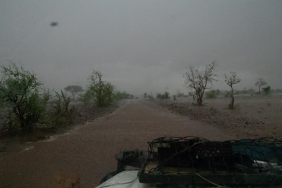
When we left Maun localised storms had already begun and some of the seasonal roads were reported to be impassable. Sometimes it is difficult to have up to date information and you just have to see when you get there but don't assume every road on the map can be driven. We found some ladies who must have got lost and spent 4 hours stuck at a river crossing. We had to drive around river crossing on occasions. On the whole we had a good range and choice of roads and no major difficulties.
The maps bought at the gate are your best reference. Better than Tracks 4 Africa which is now a bit jaded and failing to keep up to date. Many of the roads on the local map are not on Tracks 4 Africa
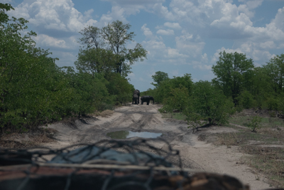
Despite campsite gossip the road from Xaxanaka to Kwai was easily passable, though we found many had gone back to South Gate and around.
The road from Kwai to the Mababe gate was wide and passable all year. The road from Mababe gate to Savuti is only passable down the sand ridge road after rains. The marsh road is good for game and only passable when dry, the gate personnel will tell you if any of the roads are not passable.
The roads around Savuti are all passable. The road to Phoha gate is apparently ill advised and what is out there is unknown. The personnel tell us that route hardly ever gets driven and should you get stuck you may need a year of supplies. Could be done with a satellite phone and / or two cars.