Masvingo
"Money often costs too much."
Raiph Waldo Emerson
From Gonarezhou we headed west to the town of Masvingo. Here we were hoping to see the famous ruins of Great Zimbabwe. Masvingo is Zimbabwe's oldest town, first established as a fort in the 1890s and called Fort Victoria. Its age and historical significance is somewhat eclipsed by the 1000 year old ruins of Great Zimbabwe situated 30 km away on the other side of Lake Kyle, but more of that later… It is on the main route between Harare and South Africa so it is a busy transport hub.
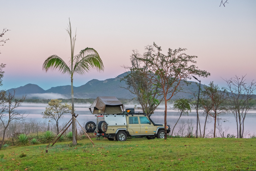
We had booked a campsite on the edge of lake Kyle called Romaldo Retreat. We had just spent 11 days without running water and we were all grubby and dirty with a distinct shortage of clean underwear. Although the campsite had a beautiful view, the facilities left something to be desired. The heating was all solar and we arrived on a particularly drab day. No hot water then. A bit of a planning booboo on the part of the lodge owners. Just when you really need hot water. We were heartened by a hot lunch at the lodge (expensive) and persuaded ourselves that cold water showers were good for us.
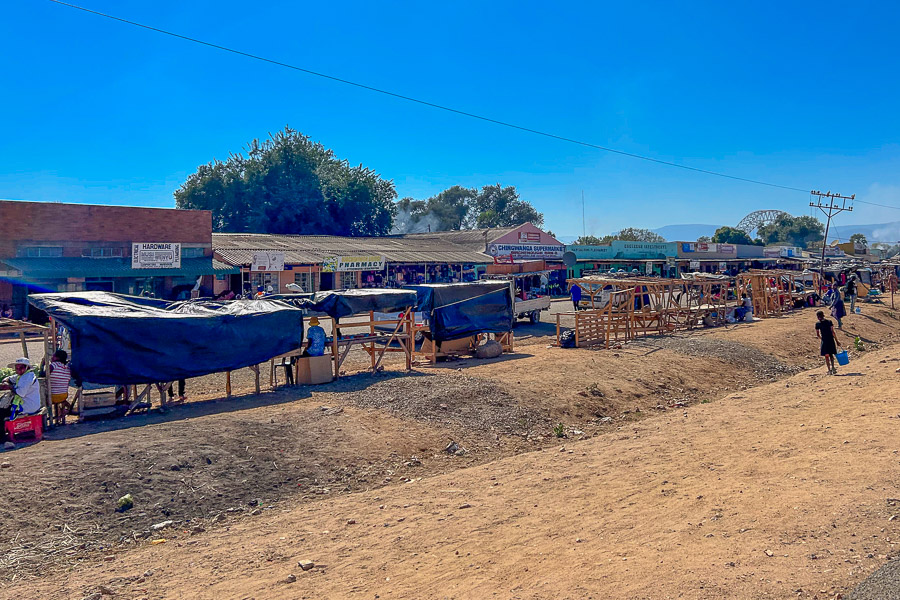
So far on our journey we had been in the bush and clear of towns and commerce. We had been living off supplies brought from South Africa but now it was time to look at real life in Zimbabwe. The supermarket!
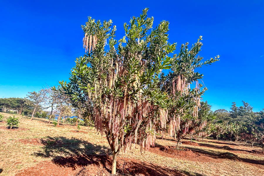
The camp had an extensive kitchen garden. Here is a macadamia tree with more flowers than I have ever seen. I am not sure if this is a good thing in terms of the crop but the area looked really fertile.
Finance, Zimbabwe Style
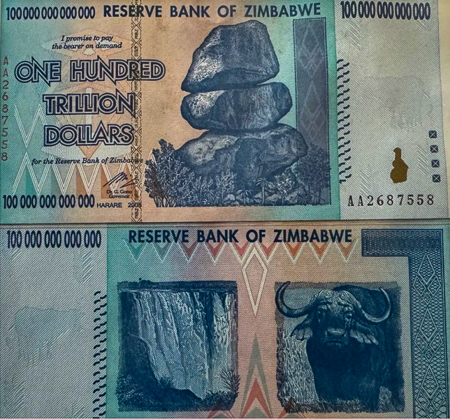
The many economic woes of the country are pretty familiar to everyone, especially the problems with hyperinflation and the devaluation of the currency. We have all marvelled over the 4 figure inflation and the million and trillion dollar currency notes we saw pinned up in bars and safari lodges across Southern Africa over the years.
Here is a brief breakdown. In 1980 the Zimbabwean dollar was launched to replace the Rhodesian dollar at par. Initial valuation was 1 ZWD to 1.47 US$. From about 1991 the value of the ZWD started to slide as a result of poor economic policies leading to mass poverty and unemployment and, in conjunction with the farm invasion and land redistribution, this led to a catastrophic crash in 2006. The ZWD was redenominated to the second Zimbabwe dollar, or ZWN, at a rate of 1000 : 1. In 2007 the inflation rate was more than 1000% and inflation was declared illegal, fixing prices.
In 2008 a second redenomination occurred from the ZWN to the ZWR at a rate of 10 billion : 1. At the same time other currencies were legalised.
This did not stop the currency slide and the government was forced to print bigger and bigger denomination notes to keep up, eventually ending in the famous 100 trillion dollar bank note. ATMs could not dispense money as there were too many zeros in the transaction for the software to process. In 2009 a fourth Zim dollar was launched, ZDL by taking 12 zeros off the currency, but during this time the economy remained almost entirely dollarized and the inflation rate soared.. The Zimbabwean dollar was officially suspended and replaced with foreign currency. In 2015 the ZWL was demonetized and its value brought to zero. The government credited accounts at a rate of 1$ US for every 35 quadrillion ZWL
Between 2006 and 2009, through 3 redenominations, 25 zeros were taken off the ZWD.
1 ZWL= 10,000,000,000,000,000,000,000,000 ZWD
That's 10 Septillion if you are wondering. You could not make it up if you tried.
How did these people cope? Zimbabweans have a reputation of being tough, resilient and adaptive for a reason. So we came well stocked with US greenbacks to see us through our trip.
However, in April 2024, 4 months before we arrived, the country floated a new currency, known as the Zig, or colloquially as the ‘Ziggy Zim’. This is the first Zim currency since 2009. We were in fact unaware of this until we actually arrived. There were no bank notes that we saw, although I believe they have been printed. . I think Carmen was given a few coins in change once. The government decreed that formal sector retailers must charge in the Zig , at a fixed exchange rate of 13:1 , and that some, if not all, wages and taxes be paid in Zig.
Even in August when we arrived, a bare 4 months after launch, the wheels were coming off the trolley and there was a parallel black market valuing the Zig over 20:1.
The main problem for us were the supermarkets where the goods were priced in Ziggy. Payment with a foreign credit card was converted to US$ or Rand at the fixed exchange rate at the till. On this first excursion, 2 shopping trolleys, an estimated R3-4000 worth of goods in SA terms, came in at R12,000. Ouch. Later we learnt to loiter outside the shops first and make shady deals with Zimbabweans to buy our goods and be reimbursed in US cash at double that exchange, which levelled the playing field somewhat. Still we were getting a taste of the cost of living in this resilient and battered country.
One of the barriers to the success of the new currency is no one has any trust and the retail sector is about 80% informal. This erodes the tax base and continues to undermine the validity of the struggling Zig. The informal markets were always happy to take our US cash, as were the National Parks and tourism and hospitality sector. The absence of any denomination below US $1 means you always buy at least $1 worth of stuff.

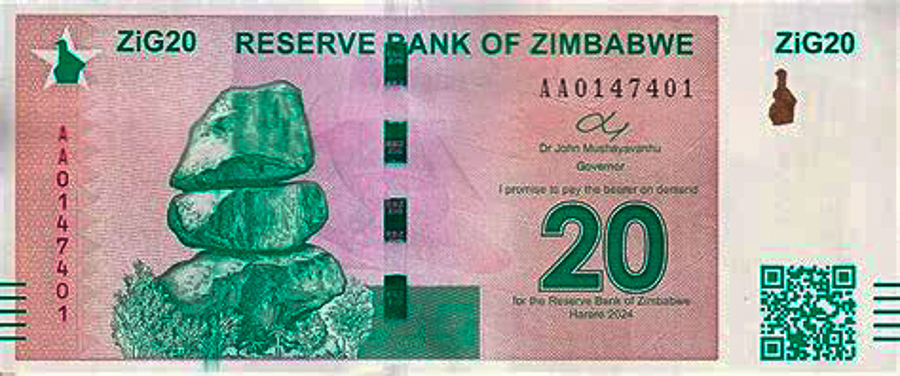
Well now we are safe at home and the Ziggy continues to look rocky. The unofficial exchange rate is now 40-50 Zig to the dollar. It was interesting to be the guinea pig of a new economy but once was enough!
Lake Kyle

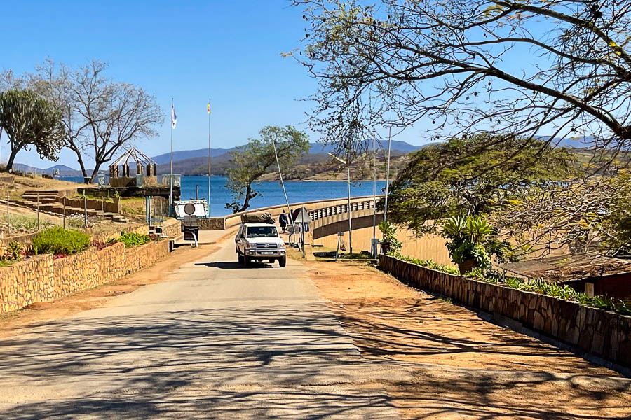
Lake Kyle from the camp
Lake Kyle or Mutirikwi, is the second biggest man made lake in Zimbabwe after Kariba. The dam was built in 1960 on the Mutirikwi river to provide water for irrigation to the lowveld farms for citrus and sugar. It was also used for recreation and fishing. The dam itself is contained in a natural granite basin. Because of the high demand and rather irregular rain fall the levels fluctuate widely and have been dangerously low in the last few years.
We were camped at Romaldo Retreat on the north east of the lake and we drove the eastern edge of the dam to the Great Zimbabwe ruins, crossing the dam wall. It was pretty, with indigenous and commercial forestry. We crossed the dam wall and stopped to take photos. We had been warned we would be harassed by water board officials to pay for the privilege and sure enough a guy with a clipboard came demanding money. I must say I can find nothing on line that says that photos are not allowed, or that a toll must be paid and I think he was chancing his arm somewhat. We smiled and waved and moved on.

The Mutirikwi dam wall
Here comes the money collector!
Great Zimbabwe
"Learn from yesterday, live for today, hope for tomorrow."
Albert Einstein
Zimbabwe means house of stone in Shona and the name Zimbabwe was taken for the name of the country at independence.
Great Zimbabwe was built over a long period of time; it was not built once and then occupied, but grew over time.
The term ‘Great’ distinguishes it from the many other smaller ruins around the region (perhaps 2-300 in all) characterised by similar cultural organisation and mortarless stone architecture .
The History
The Bantu expansion is the term for the migration of Central African peoples between 2000 BC and 1 AD. This mass population movement split into 2 broad groups, the western and the eastern expansions. The eastern expansion gave rise to the Shona and Venda people and came down the east coast, through Zimbabwe, reaching the Limpopo area of South Africa around the 4th century AD. Prior to their arrival the region was inhabited by the hunter gatherer Khoisan peoples. It is likely the migration pushed out or assimilated the preexisting groups.
The migrating peoples were historically pastoralists and agriculturalists and settled in areas around the rivers and flood plains. They farmed and counted their wealth in cattle. The centre of the community was the cattle kraal.
Around the 9th century a major change in social organisation developed when the idea of a sacred kingship was introduced. Towns and cities developed which centred around a religious and royal centre surrounded by the common people. Structures and walls were built to separate the king from the common people. These cities acted as major trading hubs with the East African trade routes to the far east, India, China and Persia. The people mined gold and iron and smelted them into tools and jewellery as well as developing special types of pottery.
Great Zimbabwe rose in power and influence spanning a period from the 11th century to the end of the 16th century. At its peak it housed up to 20,000 people and was larger than the size of medieval London.

At the end of 1600’s Great Zimbabwe was abandoned. The reason for this remains uncertain but in general it is felt it was intentional, perhaps to expand control over trade routes, perhaps because of over population or lack of resources. The population seems to have dispersed in smaller groups.
The earliest document mentioning the Great Zimbabwe ruins was in 1531 by a captain of the Portuguese garrison of Sofala on the coast of modern-day Mozambique.
The Europeans arrived only in the late 19th century. The Colonial powers refused to accept that the site was of Bantu African origin, and postulated many alternative theories for its existence including that is was built by the Phoenicians, Greeks or Egyptians, or was the site of King Solomons mines.
Because African history is primarily oral, it suffered from the absence of written documentation, allowing this racist narrative and misinformation.
Great Zimbabwe and surrounding sites were extensively looted by Europeans between the 1890s and 1920s in the belief there was hidden treasure, especially gold, causing untold damage. Often the worst of these looters were those put in charge of preserving the site. It's African origin only became consensus in the 1950s.
Great Zimbabwe was designated a UNESCO World Heritage Site in 1986 and was adopted by the new nation of Zimbabwe as a symbol of black identity and empowerment. The Zimbabwe bird and the conical tower have been used on the flag and on bank notes as symbols of African cultural pride.
The Ruins
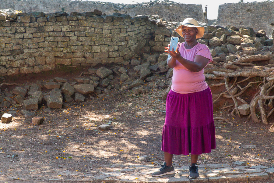
The archaeological site at Great Zimbabwe consists of 3 main sections. The Hill Enclosure, The Great Enclosure and the Valley Ruins. There is also a small museum with some historical narrative and artefacts on site. Unfortunately the museum would not allow any photos. I can't think why, it was hardly top secret.

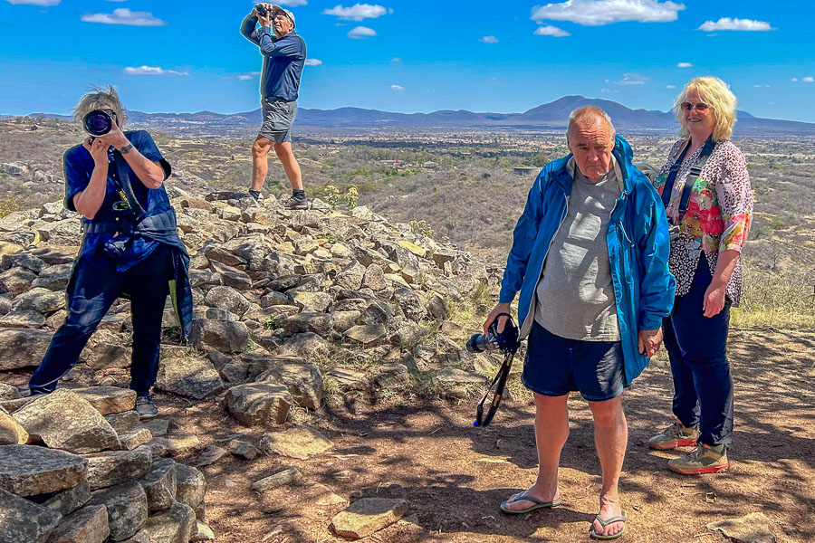
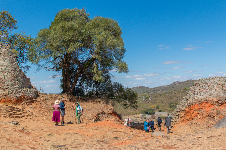
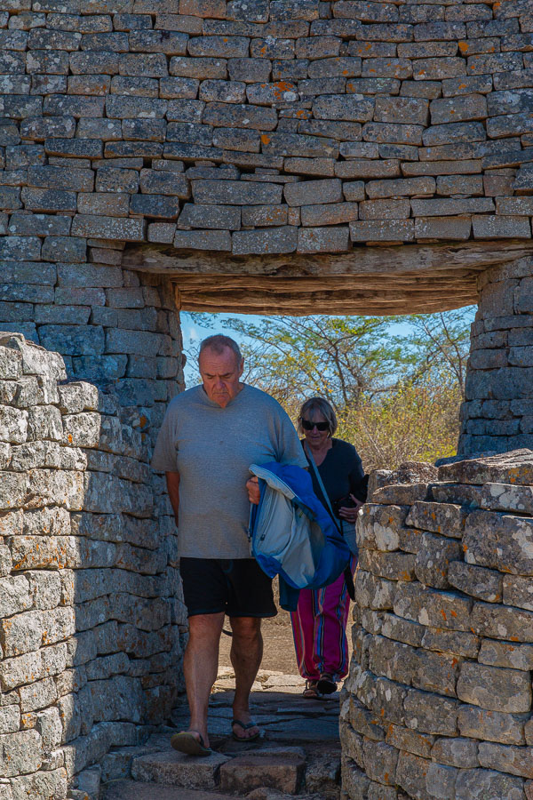
We entered the ruins down a long drive, almost like entering the park of a stately home in England. A brief negotiation at the reception hut relieved us of US$18 each for a guided tour of the site. We spent the next few hours walking the site with our guide Miriam. At the end of the trip we had to pay her again because she said she got none of the fee we paid for the guide. Zimbabwean entrepreneurship at its best!
Miriam
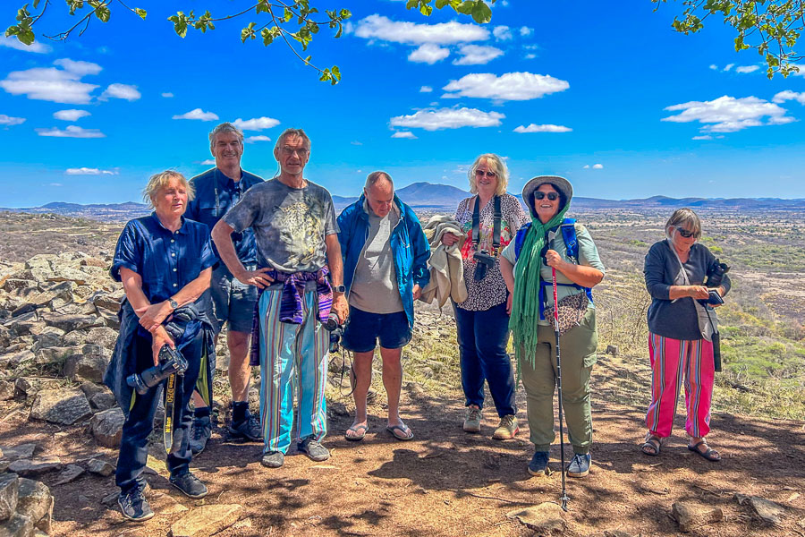
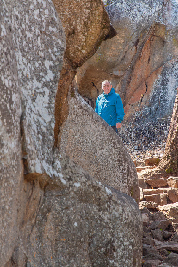
First we tackled the Hill Complex. I think Miriam was used to shepherding geriatric white people there first to make sure they still had the energy to get to the top. There is a new path constructed to the top to make it a bit more accessible. The site is 280 m above the ground. The original path is steep and somewhat eroded but Ian and Michael set off that way anyway. We all met at a flat lookout just outside the complex. It overlooked the valley and surrounding areas. This means the king had a good view over the grazing area of his cattle and crops. Also a good defensive position.
Inside the hill complex there are various areas. For audiences with the elders, religious ceremonies such as rain making rituals, and the living area for the king. An echo cave faces the Great Enclosure. Here we are told the king could shout down to the wives instructions or greetings. Apparently he had 200 wives so that’s a lot of shouting.
At the very top of the hill is a ruined balcony which allows a rather vertiginous overview of the ruins.

The area still carries a strong spiritual reputation. Miriam claims that there is a passageway from the Hill Complex down to the Great Enclosure. Maybe it was a route for the wives to visit the king.
The tunnel has since been closed off. It attracted a lot of treasure seekers who felt gold was buried there, causing damage with unplanned excavation. It also had a strong spiritual power. Only the bravest medicine men would venture there as it brought death and misadventure to the unwary.
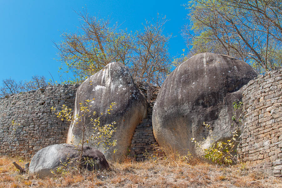
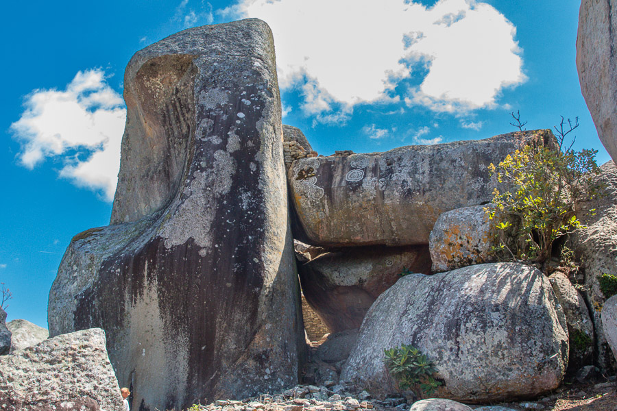
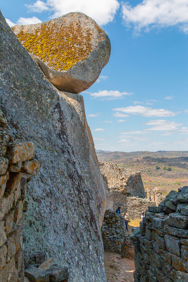
Many of the walls snaked around huge granite rocks and boulders, incorporating them in the design
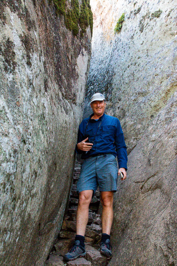
Steep pathways up into the Hill Complex.
View of the Great Enclosure from the Hill Complex

View from the balcony
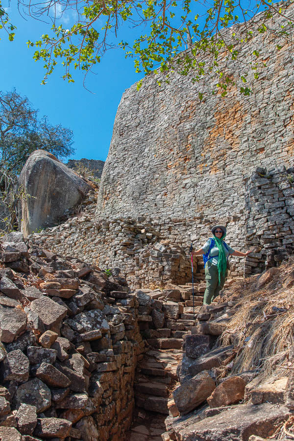
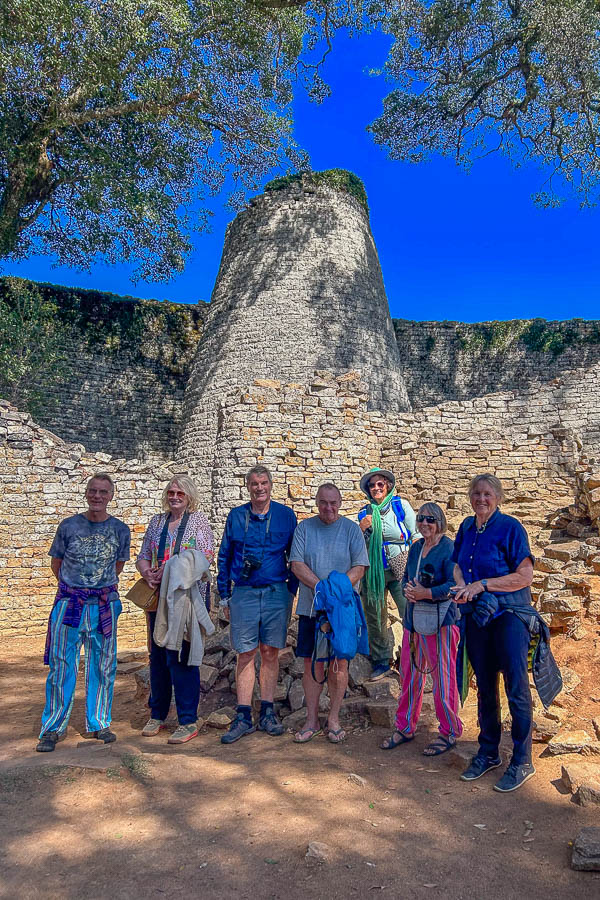
The ruins of the second section, the Great Enclosure, are perhaps the most exciting. The Great Enclosure is a walled, circular area below the Hill Complex dating to the 14th century. The walls are up to 11 meters high in places, and the enclosure’s circumference is 250 meters. The stones for the walls were carefully chosen for size and shape and the bottom of the wall is much thicker for stability. The walls were built without mortar, relying on the carefully shaped rocks to hold the shape of the wall on their own. This curved and sinuous engineering is technically advanced.
The Great Enclosure is the largest existing ancient structure in sub-Saharan Africa.
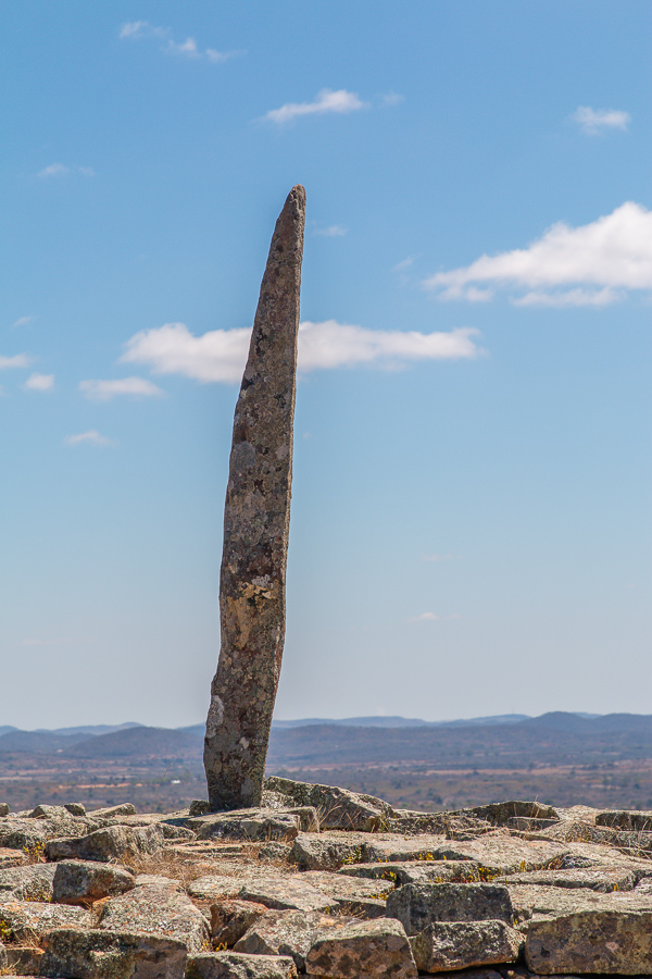
Inside the enclosure is a second set of walls, following the same curve as the outside walls and creating a narrow shaded passageway which ends in a conical stone tower 10 meters high. It’s function is unknown but has been postulated to have been a grain store or phallic symbol. It seems that limited excavations have not shown it to be hollow which makes its use as a store a bit unlikely.
It is thought that high ranking citizens lived in the Great Enclosure, including the wives of the king. There are remains of daga huts there and it is thought each wife had her own hut.

The walls around the Great Enclosure are up to 11m tall.
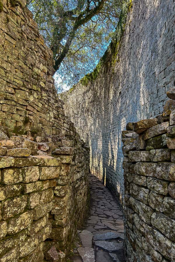
There are narrow cool passages which snake around the perimeter wall.
Wooden lintels are built into the stone work. Sagging a bit after 500 years.
The famous conical tower
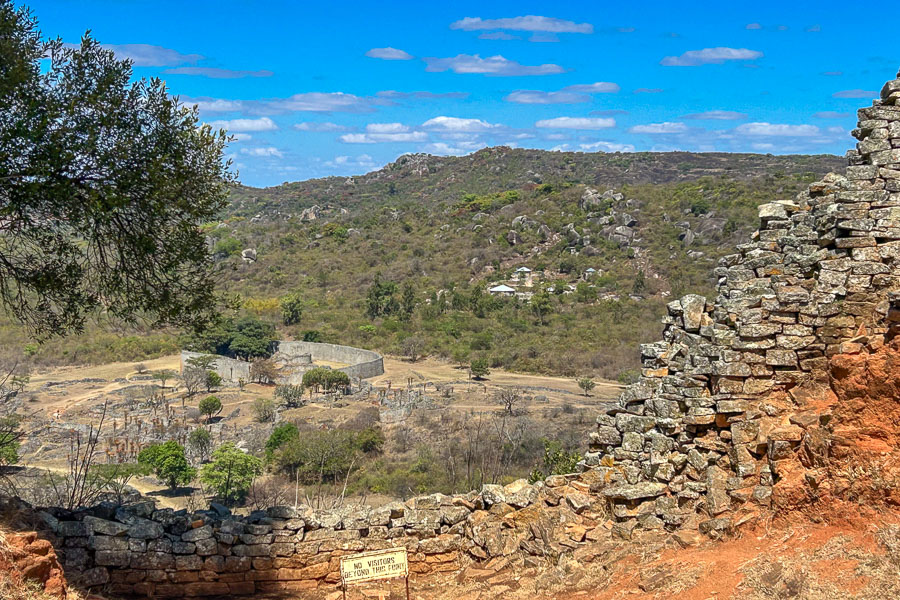
Adjacent to the Great Enclosure, the Valley Ruins require a bit more imagination. This area was for the common people and little remains of the mud brick and reed buildings (daga huts) that stood there.
There is however a modern Shona Village further down the hill which gives some context to the type of architecture and living conditions which would have prevailed.
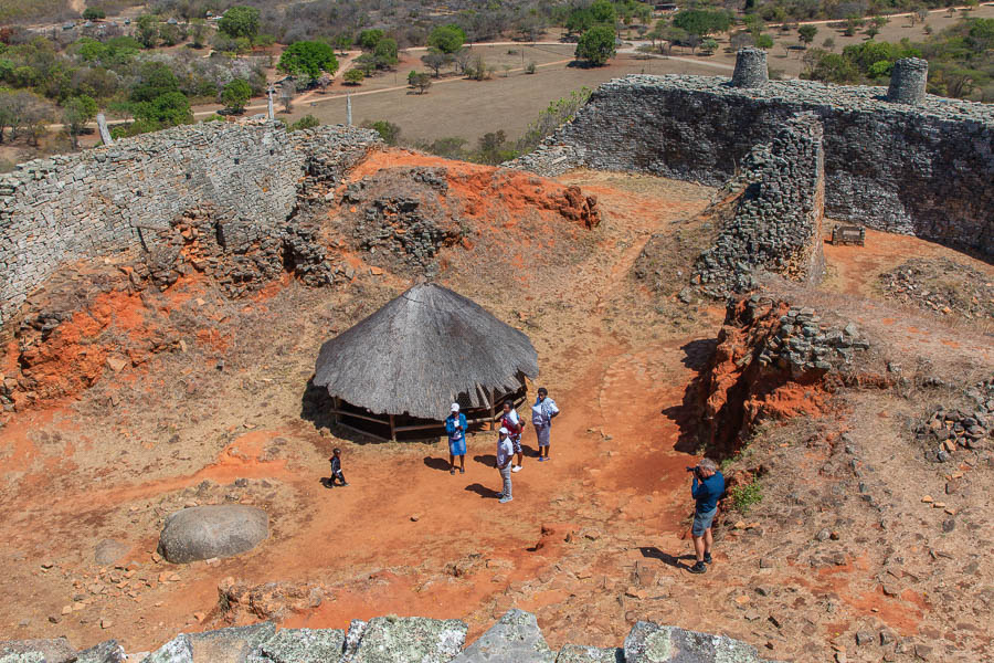
A facsimile of one of the daga huts
In the grounds of the Great Zimbabwe complex is a museum documenting some of the history and showcasing coins from Arabia, tools, glass beads, jewellery and Chinese and Persian pottery found at the site.
Archaeological research has unearthed several soapstone bird sculptures in the ruins. These birds are thought to have served a religious function, and may have been displayed on pedestals in the Hill complex. They are said to represent the bateleur eagle, but on our tour the guide claimed they were fish eagles. As the carvings are stylised its anyones guess. These symbolic birds, known as the Zimbabwe bird, appear on the modern Zimbabwean flag. One of the birds was presented to Cecil Rhodes and sits in his Cape Town home.

In the sand at Great Zimbabwe someone had drawn a copy of the stylised bird totem. It's the nearest to a photo I could get.
On the flag of Zimbabwe the Zimbabwe bird is seen on the red star.

It was a long hot day and fascinating in terms of the cultural and historical implications. It looks like a lot more work is needed to preserve it from the elements and the feet of tourists. I am sure there are more stories to be told here but whether they will be heard, or whether they are lost forever remains to be seen.
We waved goodbye and returned to our campsite at the lake. At least the sun had shone on our solar geyser and we could look forward to steaming hot water and clean underwear.
Great Zimbabwe is well worth a visit but is unlikely to tempt you back for more.