Lubango

“Go to the streets that you have never been to! Wander in the places that you have never known! There is light in the hidden corners of life too! Expand your frontiers and the frontiers will expand you!”
Mehmet Murat ildan
Lubango is a city of over 1,000,000 people, capital of the Huila province and the second most populated city in Angola after Luanda. It is an agricultural and transport hub on the Mocamedes railway from Namibe to Menongue.
It lies at an altitude of over 1700m in a valley of the Huila plateau and the climate is hot in the day but can drop to below 0C at night in winter. We would have to wrap up at night that was for sure.


Getting There

Fields of rubbish in some areas near the towns.
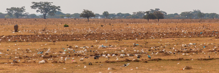
We knew this would be a hard slog. Nearly 500 km but on tar. The road was in better shape than we anticipated, long and straight with villages intermittently. Initially they were poor but clean but the nearer the bigger towns the more rubbish appeared. One area was so bad it looked like a whole crop of rubbish covering the fields as far as the eye could see.
It is a familiar but depressing sight in Africa. No formal rubbish management in an increasingly disposable world.
On the road there were far more Vespa taxis and Kewasaki tricycles than cars and they dodged and dived and sometimes felt like midges buzzing around your head.
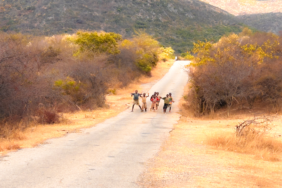
We stopped for some lunch with our pao in what we thought was a deserted stretch but ended up next to a village. Many came to stand and stare solumnly. They really appeared hungry and we parted with bread and cornflakes, butternut and biscuits. From then on we always bought double the pao we needed because we always had guests for lunch.
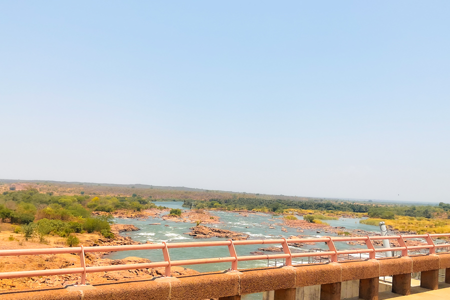
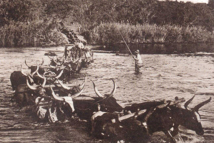
Crossing the Kunene River

Matale town centre.

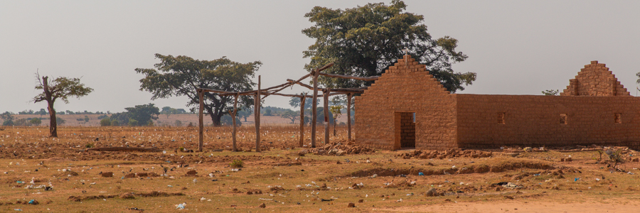
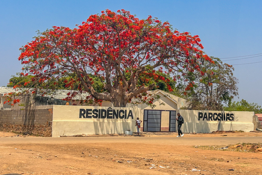
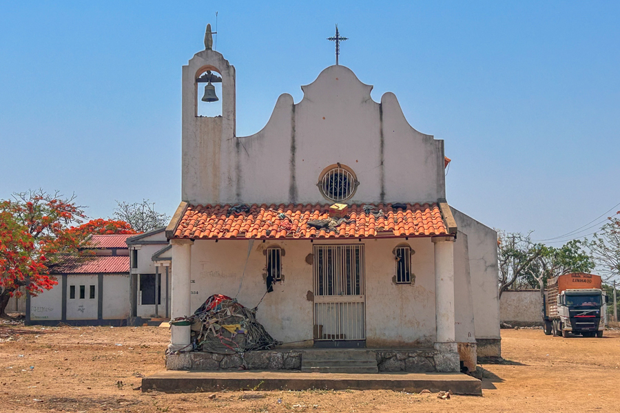
The villages and small towns had scattered buildings with old Portuguese architecture like this small church.
Here we are parked in the town square with the Unitel shop, that finally resolved our communication crisis, in the background. Mind you it cost us a couple of hundred dollars US.

Early afternoon we hit a small town called Matale and were able to sort the SIM cards. Hurrah. Now we knew Michael was in Lubango waiting for us and had found all the instructions we had left him for the campsite. We had a cool drink in a funny little cafe. The stock was so low you wonder how they make a living. The toilet was a hole in the ground and a blue bucket.
Dudley was worried about his air filter and battery warning lights but probably just another loose connection. There is no rest with the Beast, she was very attention seeking this trip.
Finally we rolled into Lubango. A huge city compared to everywhere else we had been.
It took us 30 mins just to navigate the traffic to our meeting place in a cafe by ShopRite.
Stefan had given us the contact for a South African, Duran, who owned a cafe near ShopRite and allows overlanders to camp on his lawn.
He lived outside town, further up the escarpment and his house was walled and relatively quiet out of the hubbub of the city.

Reunited! Note the look of relief on Mike's face that he made it back into the fold. He very nearly ran out of fuel on the way up. Fuel mafia hah!
Actually the Namibians come into Angola on the weekends to fill up so, counterintuitively, fuel can be more difficult to find on the main routes as they empty the pumps.
Michael had found Duran earlier in the day and secured camping and we met Mike at the cafe and all had a lovely supper and a few drinks before driving up the hill to Duran's place.
He had a flat lawn and outside shower and toilets for us to use, all we needed really. He also had 4 rambunctious dogs but we all got along famously and we had a lovely night.
Au Revoir Vicky
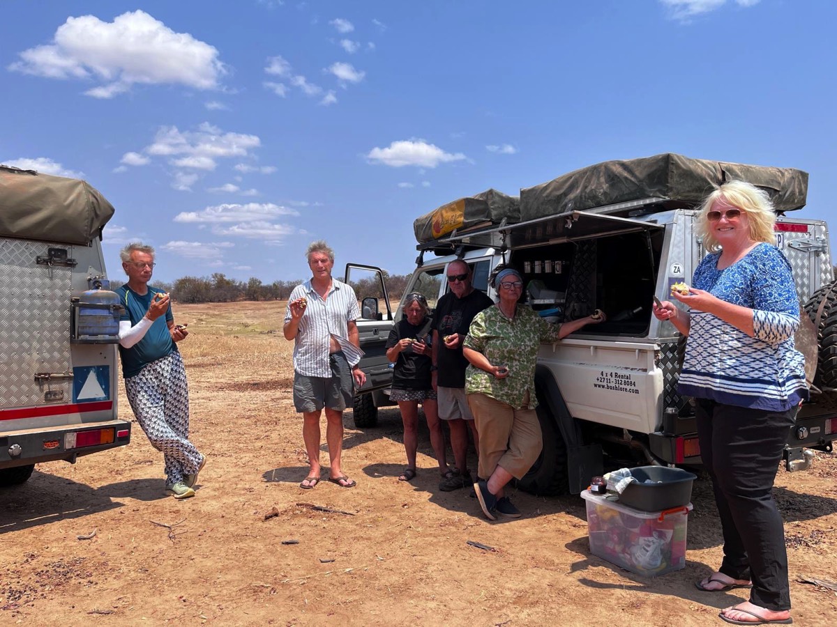
Here we are eating Vicky's never to be forgotten bush scones for Mikes birthday!
A negative to our reunion was the absence of Vicky. They had been driving up to meet us in Menongue when Vicky received news from home. Her mum, who had been unwell for some time, had taken a turn for the worse and she decided to fly home.
Michael turned around the car and drove her most of the way to Windhoek before turning back to brave the border again.
You see he also had an Encore Angola moment. Their border crossing was even more hairy than ours. The internet was down and some guys smuggling bullets got beaten up by the police. It took them 6 hours first time around.
I think the poor communications and uncertain support systems and itinerary in Angola added to her decision which was, as it turned out, exactly the right thing to do.
We were no longer the secret seven, we were now the psycho six.
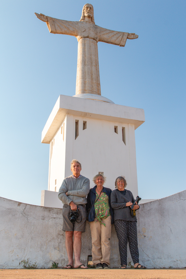
Christ the Redeemer

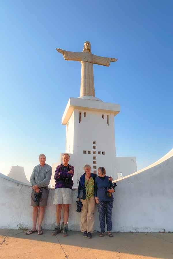


Next day we awoke early and headed for a local highlight, Christ the Redeemer statue, close to Duran’s place.
It is on a hill overlooking the city, a bit like the Rio landmark, and there is a big name plate for Lubango close by, lit at night.
We found the statue at the end of a gravel road on top of the escarpment overlooking Lubango. There were a couple of “guards” but they left us alone.
The air was hazy making photography difficult but we had a panoramic view of the city, the rail yards and buildings.
The other highlight of Lubango is a place called Tumbavalle , a vista of craggy cliffs, also on the escarpment. Mike had gone the day before and was not keen to revisit so Duran suggested we try Bimbe viewpoint, a similar but less visited panorama. It was in the direction we were going so off we set.
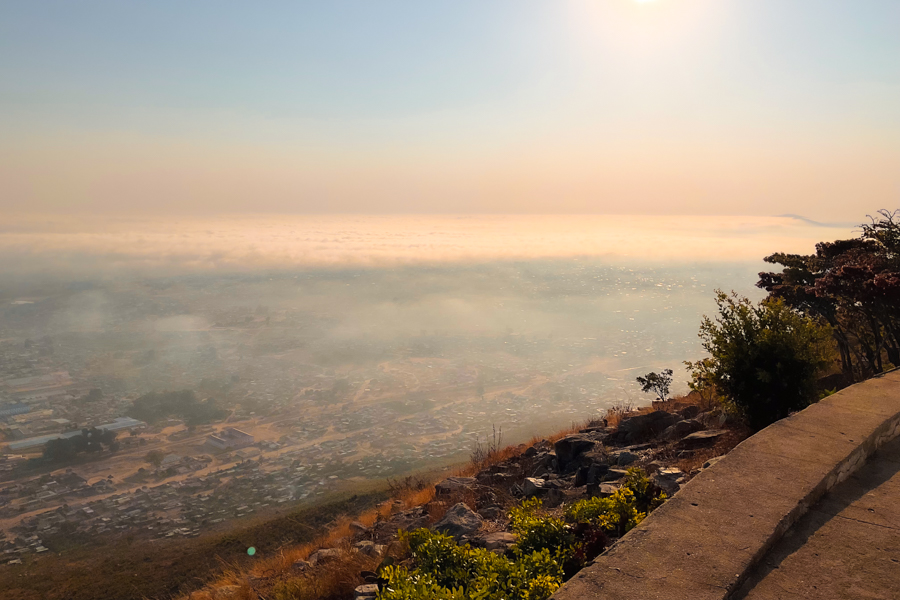
As the mist lifted we could see the city of Lubango laid out below us.


This huge city sign is lit up at night like the Hollywood hills.

Humpata
The route to Bimbe view was through the town of Humpata. This agriculturally rich area is in the highlands behind Lubango where the South African Dorsland Trekboers came, settled and farmed very successfully. They were given land and Angolan citizenship for contributing to the colonisation of the interior.
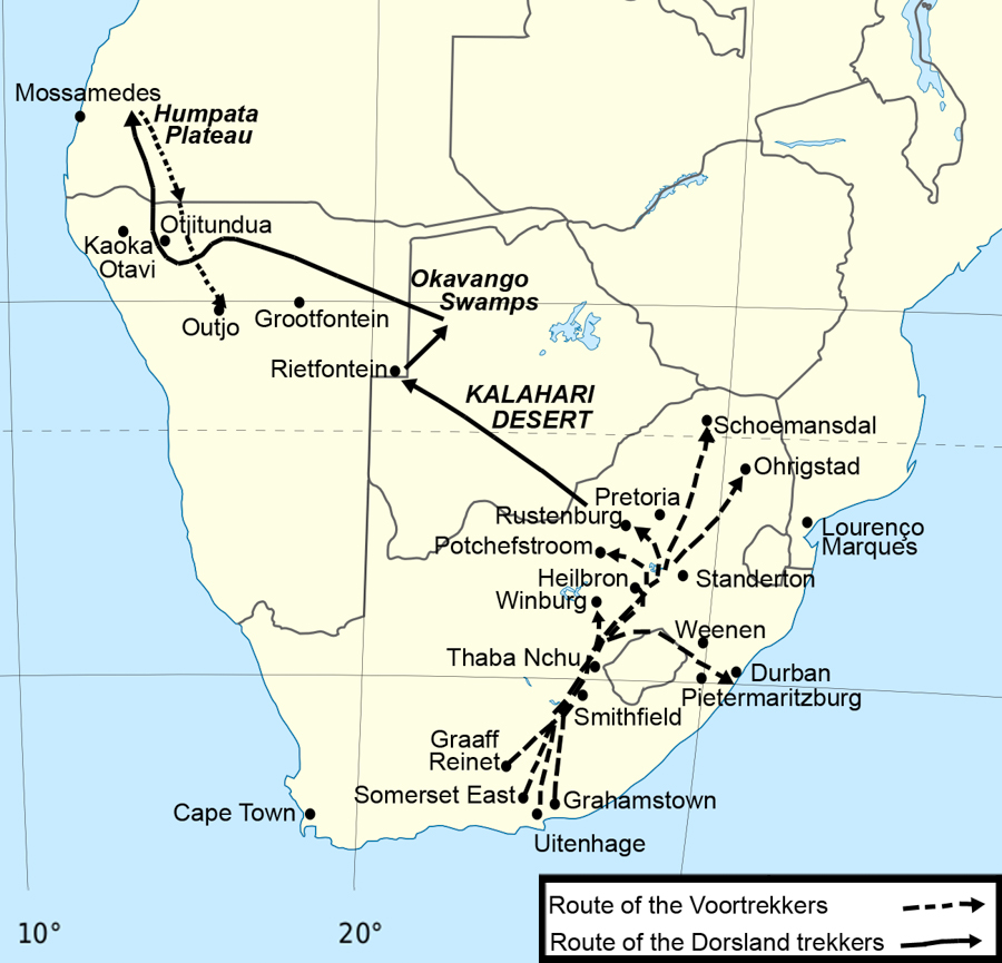
After the Great Trek, from the Cape to the Transvaal, a community arose which consisted of a few Voortrekkers spread across a large geographical area in the Transvaal. However there was no unity or leader amongst them and serious political and church disputes, even violent clashes occurred. In 1875 several small groups of aggrieved Boers decided to leave the Transvaal in search of a "better land to live in". Some were even under the impression they could trek to Jerusalem.
"Dors" means "thirst" in Africaans and this movement was known as the Dorsland or Thirstland Trek as their route took them through the Kalahari and Namibian deserts and Okavango swamps with much hardship and loss of life from drought and disease. There are memorials to the Dorsland Trekkers in various desolate spots, including in Etosha at Rietfontein waterhole where there are also graves. They spent quite a lot of time in northern Namibia. Eventually, in 1880, a group of around 370 settled in Humpata in Angola.
During its time as a colony, the Portuguese used to refer to most of the interior of the country as the ‘land beyond the end of the world’ and they had policies and incentives to try and get white settlers in these areas. The ultimate land beyond the end of the world was in the south east where we had come from, hence the poor infrastructure and development, but in fact it was a term for anywhere not on the coastal strip.
At the same time as the Dorsland Trekkers arrived a group also arrived from Madeira and so these 2 groups became the dominant settlers in the area.
In the early 1900s the boers left because they felt their culture and language was becoming eroded by the Portuguese influence and they settled in Northern Namibia. Despite this, clearly the agricultural heritage lives on.
We drove past strawberry farms and citrus orchards and lots of fruit and veg were being sold by the road.
The town was small and sort of more organised than the usual Angolan small town. It’s the Africaans influence you know!

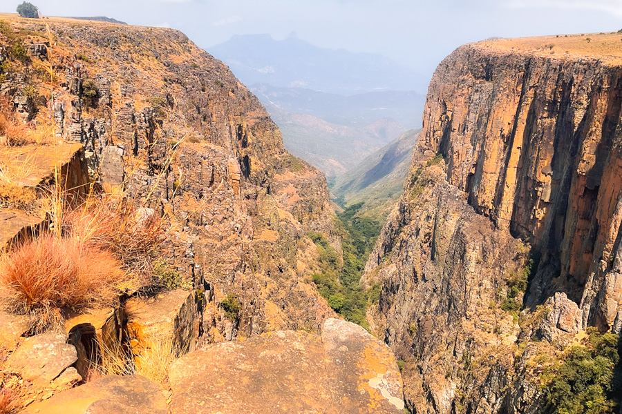
Bimbe View


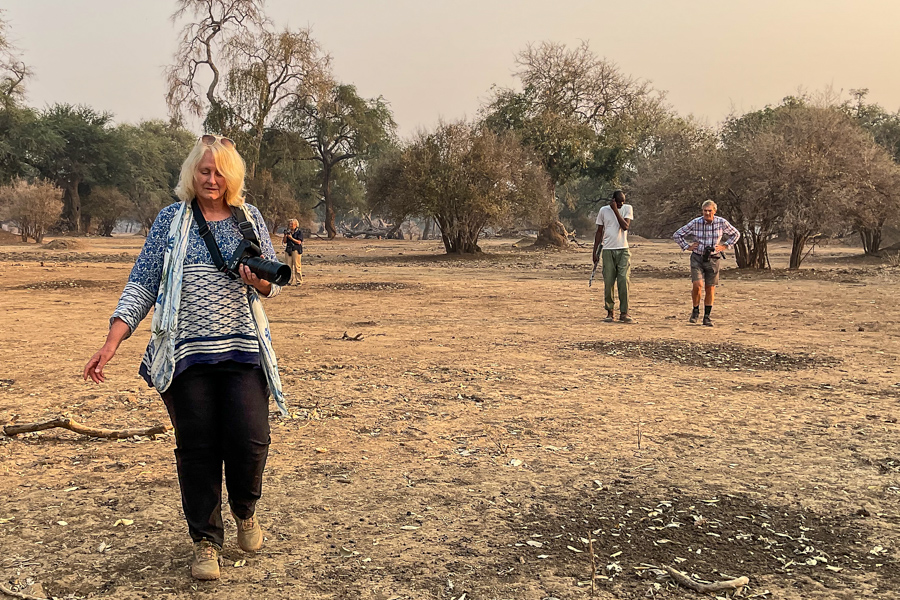
We bought pao and strawberries and headed up the track to Bimbe. Of course the estimated time of 1 hour was a wild underestimation and it took us 2 hours or more to slowly crawl go up the stony sandy track to the escarpment.
We reached an abandoned agricultural research station. There were many barns, dairies and paddocks. 2 guys met us at the gate and, although this was mostly mime, told us it would be 3000 kwanza a car and clearly we needed a guide.
One guy jumped in Ian’s car and off we continued down rocky tracks. Wide plains with cows and goats grazing and a series of dams took us to the look out on the top of the escarpment.
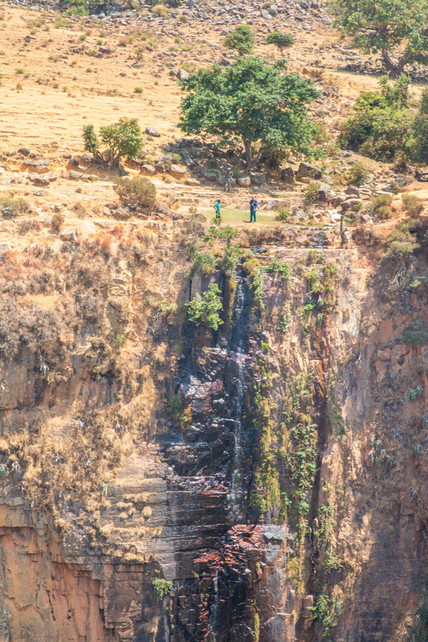
A waterfall fell glittering into the chasm and there was a deep crevice through which we could look out on the mountains and valleys beyond.
We spent an hour or so on the edge taking photos. Dudley launched the drone.

Dudley launched the drone to follow the walls of the canyon.

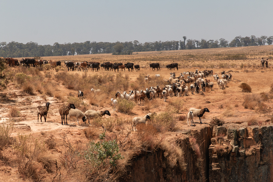
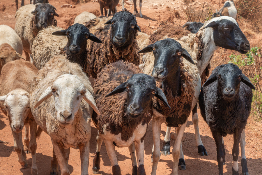
We wanted lunch but then all the herds in the area seemed to converge on us accompanied by a variety of solemn and ragged shepherds. Clearly we did not have enough food to eat there so we climbed in the car and drove to a small copse of trees where we brewed coffee and ate pao with cheese and jam and peanut butter.
We had bought a lot of pao so when some of the more enterprising shepherds found us there we were able to share. They loved the butter and jam and ate it in huge slabs. Still there are no fatties in Angola so you cannot deny them their calories.
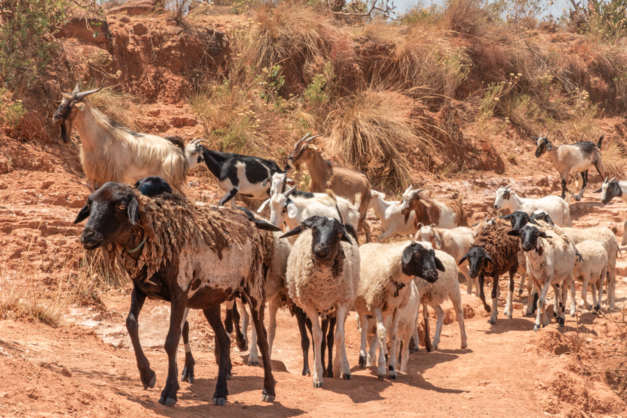
Even the sheep looked like they wanted some lunch. Just look at those little faces!
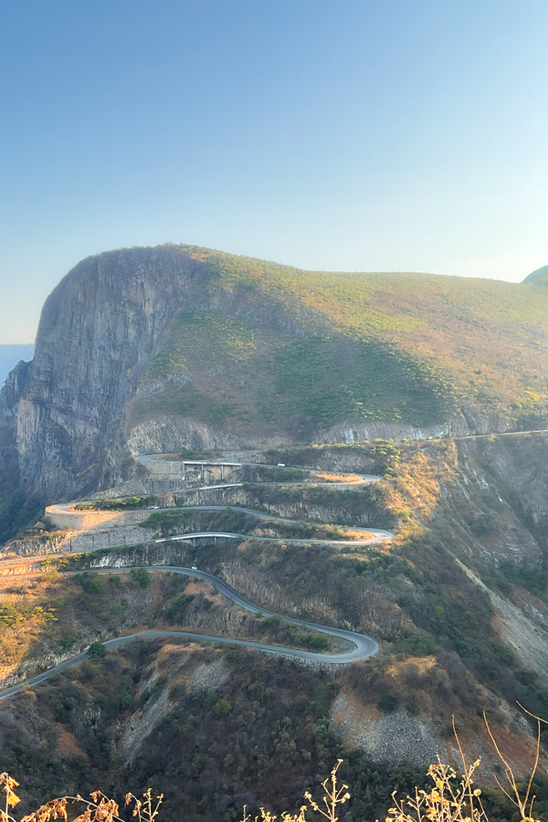
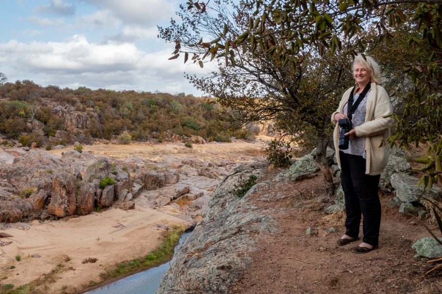
Serra da Leba Pass
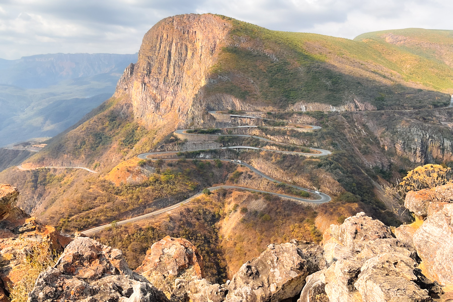
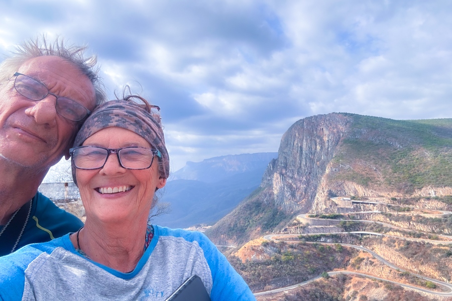
We crawled back down the road to our camp. On the way we stopped at the lookout for Serra da Leba pass, to take photos in the late afternoon light.
We also wanted to see what we would be up against when we travelled down there next day.
Serra da Leba is the name of a mountain range located on the boundary of Huíla and Namibe provinces, 40 km outside Lubango.
The pass is one of the most famous hairpinned roads in the world. At 29.4 km long it drops from the high plateau at 1700m to sea level in a distance of 10 km.


It traverses 3 or 4 climate zones in the descent and is steep in places, up to 34% gradient.
It is not recommended you drive it in the rain, it has little guard rail protection and has been the scene of many fatalities. It’s nick name is “the beautiful precipice”.
The views were spectacular, a few local guys were skulking, trying to sell rocks and wilting plants. The children came to dance for pennies.
Life for these people is tough. We had to restrain Sonia from handing out fistfuls of cash.
We slept well, wrapped up against the cold and full of Humpata strawberries. Tomorrow we will brave the pass down into the coastal plain and head for the beach